Whale Beach to Avalon
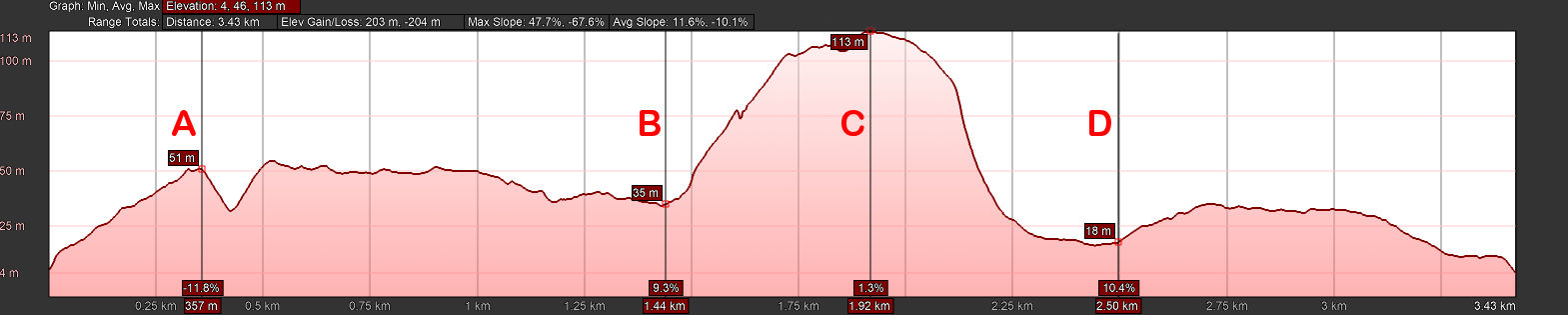
The walk from Whale Beach to Avalon Beach combines paved roads (approximately 2.37km) with unpaved tracks (1.06km). The unpaved section is relatively challenging, with numerous steps and a rugged climb to the highest point on Sydney's northern coastline. However, the spectacular views, stretching south all the way to the city and north over Broken Bay to the Central Coast, are well worth the effort.
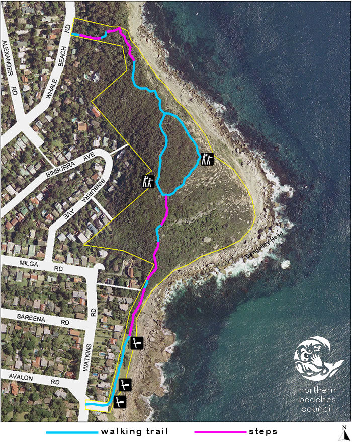
The track passes through Careel Headland Reserve and Bangalley Head Reserve, where native plants and abundant birdlife create the feeling of being far removed from the urban environment.
Directions
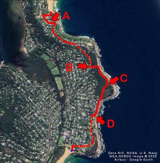
For these directions, I'll be referring to the picture below with its reference points.- To leave Whale Beach, head to the south end of the beach. Between the public toilets and the ocean pool, you'll find stone steps leading up the hill to Malo Road.
- Climb Malo Road to its intersection with Whale Beach Road and turn left. This is a relatively steep 360m section until you reach point A.
- From point A to point B, follow Whale Beach Road. Even though you're walking on a road, there are several spots offering beautiful views of the ocean and headlands.
- At point B, you leave the road and enter the track. It begins with a steep 500m climb featuring many steps, continuing until you reach point C—the highest point of the entire walk. In this section, there's an optional track that goes deeper into the bush. I preferred the track closer to the cliff, which provides more open ocean views.
- The track continues to point D via a steep 600m descent with numerous stepped sections. Along this stretch, you'll see Avalon Headland and the city skyline on the distant horizon.
- Turn right at the end of the track onto Marine Parade. Head south along Marine Parade for another 900m until you reach the sands of Avalon Beach.
The next picture shows a more detailed map of just the track, with different colours indicating walking and stepped sections.
Track Details
- Australian Walking Track Grading: Grade 3 (moderate)
- Total length: 3.43 km
- Time: Approximately 1 hour 40 minutes
- Highest point: 133 m
- Steepest ascent: 47%
- Steepest descent: 67%